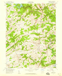
1958 Map of Hereford
USGS Topo · Published 1959About this map
Gunpowder Falls carves a deep path through the northern Baltimore County landscape, defining a region of steep valleys and upland plateaus. By the late 1950s, the area maintained a rural character even as the Baltimore-Harrisburg Expressway began to cut across its center. The Pennsylvania railroad follows the winding river corridor through Glencoe and Sparks, where local hubs like Sparks Sta and Glencoe Sta served as vital connections to the city. Significant water management features dominate the periphery, with the Prettyboy Reservoir to the northwest and the northern reaches of Loch Raven Reservoir to the southeast.
Find a feature on this map
70 named features on this map. Tap any name to fly to it.
Don’t see what you’re looking for? This feature index may not catch every label — zoom into the map to look around manually.
Map Details
Editions of this 1958 Hereford Map
Other maps of this area

1892 · Ellicott
USGS Topo · 1:62,500

1894 · Ellicott
USGS Topo · 1:62,500

1894 · Baltimore
USGS Topo · 1:62,500

1899 · Baltimore
USGS Topo · 1:62,500

1900 · Parkton
USGS Topo · 1:62,500

1902 · Parkton
USGS Topo · 1:62,500

1904 · Baltimore
USGS Topo · 1:62,500

1905 · Westminster
USGS Topo · 1:62,500

1906 · Ellicott
USGS Topo · 1:62,500

1908 · Patapsco
USGS Topo · 1:125,000