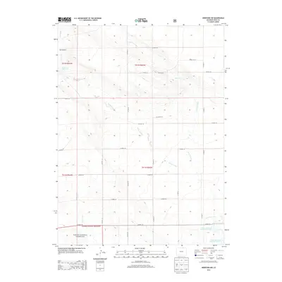
2013 Map of Hereford NW
USGS Topo · Published 2013About this map
Pawnee National Grassland dominates the southern portion of this Weld County landscape, where the high plains transition into complex drainage systems and canyon breaks. The area is defined by a sparse ranching infrastructure, exemplified by Peters Ranch and a network of numbered county roads that follow the section lines of the Public Land Survey System. Water management is a central feature of this arid environment, with the Adams and Bunker Reservoir Number 1 and Adams and Bunker Reservoir Number 3 collecting vital runoff in the southeast, while Eagle Rock Reservoir sits to the west. The terrain is deeply carved by Simpson Creek, Little Crow Creek, and Geary Creek, which have sculpted landmarks such as Bull Canyon and the secluded Lost Valley. This survey captures the region just after the turn of the 21st century, showing how the land remains primarily dedicated to conservation and large-scale ranching.
Find a feature on this map
29 named features on this map. Tap any name to fly to it.
Don’t see what you’re looking for? This feature index may not catch every label — zoom into the map to look around manually.
Map Details
Editions of this 2013 Hereford NW Map
This is the sole edition of this map. No revisions or reprints were ever made.
Other maps of this area

1908 · Eaton
USGS Topo · 1:125,000

1910 · Eaton
USGS Topo · 1:125,000

1911 · Cheyenne
USGS Topo · 1:125,000

1914 · Cheyenne
USGS Topo · 1:125,000

1954 · Cheyenne
USGS Topo · 1:250,000

1954 · Greeley
USGS Topo · 1:250,000

1957 · Greeley
USGS Topo · 1:250,000

1958 · Cheyenne
USGS Topo · 1:250,000

1958 · Greeley
USGS Topo · 1:250,000

1961 · Greeley
USGS Topo · 1:250,000