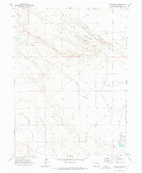
1972 Map of Hereford NW
USGS Topo · Published 1975About this map
Peters Ranch stands as a focal point of human activity in this high plains landscape of northern Weld County, where the drainage patterns of the Colorado-Wyoming border region take center stage. The terrain is defined by a network of seasonal watercourses, including the steep-sided Bull Canyon in the northwest and the winding paths of Simpson Creek, Porter Creek, and Geary Creek. These waterways and their associated Spring and Springs labels indicate the vital role water played in the ranching operations of the early 1970s.
Find a feature on this map
9 named features on this map. Tap any name to fly to it.
Don’t see what you’re looking for? This feature index may not catch every label — zoom into the map to look around manually.
Map Details
Editions of this 1972 Hereford NW Map
This is the sole edition of this map. No revisions or reprints were ever made.
Other maps of this area

1908 · Eaton
USGS Topo · 1:125,000

1910 · Eaton
USGS Topo · 1:125,000

1911 · Cheyenne
USGS Topo · 1:125,000

1914 · Cheyenne
USGS Topo · 1:125,000

1954 · Cheyenne
USGS Topo · 1:250,000

1954 · Greeley
USGS Topo · 1:250,000

1957 · Greeley
USGS Topo · 1:250,000

1958 · Cheyenne
USGS Topo · 1:250,000

1958 · Greeley
USGS Topo · 1:250,000

1961 · Greeley
USGS Topo · 1:250,000