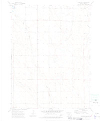
1972 Map of Hereford
USGS Topo · Published 1975About this map
Little Crow Creek and Crow Creek define the drainage patterns of this high plains landscape in Weld County. This 1970s topographic study reveals a terrain characterized by subtle elevation changes and an intermittent water network typical of the eastern Colorado steppe. The map shows the branching paths of Geary Creek as it moves across the prairie, providing a detailed record of the natural hydrology and land divisions before more recent agricultural or residential development. It is an essential document for those studying the environmental history and the foundational rural structure of this portion of the Western United States.
Find a feature on this map
3 named features on this map. Tap any name to fly to it.
Don’t see what you’re looking for? This feature index may not catch every label — zoom into the map to look around manually.
Map Details
Editions of this 1972 Hereford Map
2 editions found
Other maps of this area

1954 · Cheyenne
USGS Topo · 1:250,000

1954 · Greeley
USGS Topo · 1:250,000

1957 · Greeley
USGS Topo · 1:250,000

1958 · Cheyenne
USGS Topo · 1:250,000

1958 · Greeley
USGS Topo · 1:250,000

1961 · Greeley
USGS Topo · 1:250,000

1963 · Arcola
USGS Topo · 1:24,000

1963 · Carpenter
USGS Topo · 1:24,000

1963 · Pine Bluffs SW
USGS Topo · 1:24,000

1964 · Greeley
USGS Topo · 1:250,000