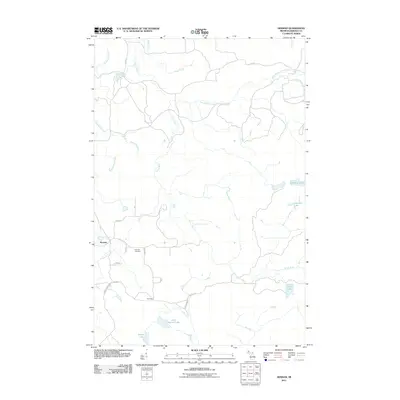
2011 Map of Herman
USGS Topo · Published 2011About this map
Herman sits within the heavily forested terrain of Baraga County, serving as a focal point for a landscape defined by its complex network of waterways and early 21st-century rural routes. The Silver River and its East Branch carve through the terrain, featuring notable landmarks such as Upper Silver Falls and Harley Falls. The presence of the Herman Cemetery and the settlement of Summit further south reflect the enduring community footprint in this part of Michigan. Local roads, often bearing family or regional names like Keranen, Huhtala, and Taisto, provide access to several secluded water bodies, including Kortio Lake and Little Summit Lake. This topography illustrates a region where the natural environment of the Upper Peninsula dictates the patterns of local travel and historical land use along roads like Celotex Rd and Tama Siding.
Find a feature on this map
28 named features on this map. Tap any name to fly to it.
Don’t see what you’re looking for? This feature index may not catch every label — zoom into the map to look around manually.
Map Details
Editions of this 2011 Herman Map
This is the sole edition of this map. No revisions or reprints were ever made.
Other maps of this area

1954 · Skanee
USGS Topo · 1:62,500

1954 · Keweenaw Bay
USGS Topo · 1:62,500

1955 · Herman
USGS Topo · 1:62,500

1956 · Three Lakes
USGS Topo · 1:24,000

1956 · Michigamme
USGS Topo · 1:62,500

1958 · Iron River
USGS Topo · 1:250,000

1960 · Iron River
USGS Topo · 1:250,000

1961 · Iron River
USGS Topo · 1:250,000

1967 · Iron River
USGS Topo · 1:250,000
1984 · Aura
USGS Topo · 1:24,000