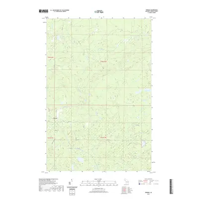
2019 Map of Herman
USGS Topo · Published 2019About this map
The settlement of Herman serves as the focal point for this survey of the Baraga County highlands. This region of Michigan is defined by a series of named crossroads and clusters that reflect the area's local heritage, including Lahti, Lystila, Oikarinen, and Torvinen. These locations, many situated along the Herman Nestora Rd and Celotex Rd, point to the dispersed nature of habitation in the Northwoods. Central to the community is the Herman Cem, a key landmark for genealogical research in L'Anse Township.
Find a feature on this map
36 named features on this map. Tap any name to fly to it.
Don’t see what you’re looking for? This feature index may not catch every label — zoom into the map to look around manually.
Map Details
Editions of this 2019 Herman Map
This is the sole edition of this map. No revisions or reprints were ever made.
Other maps of this area

1954 · Skanee
USGS Topo · 1:62,500

1954 · Keweenaw Bay
USGS Topo · 1:62,500

1955 · Herman
USGS Topo · 1:62,500

1956 · Three Lakes
USGS Topo · 1:24,000

1956 · Michigamme
USGS Topo · 1:62,500

1958 · Iron River
USGS Topo · 1:250,000

1960 · Iron River
USGS Topo · 1:250,000

1961 · Iron River
USGS Topo · 1:250,000

1967 · Iron River
USGS Topo · 1:250,000
1984 · Aura
USGS Topo · 1:24,000