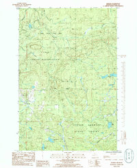
1985 Map of Herman
USGS Topo · Published 1986About this map
The L'Anse Indian Reservation occupies the central and northern reaches of this mid-1980s survey, defined by its boundary lines and the dense woodlands of the Copper Country State Forest. The settlement of Herman serves as a local anchor in the west, while the smaller locality of Summit sits further south near the rail line and the headwaters of Tama Creek. This geography reflects a period where the timber and resource extraction industries were established fixtures, indicated by the presence of a Quarry and Gravel Pit amid the high ground.
Find a feature on this map
23 named features on this map. Tap any name to fly to it.
Don’t see what you’re looking for? This feature index may not catch every label — zoom into the map to look around manually.
Map Details
Editions of this 1985 Herman Map
This is the sole edition of this map. No revisions or reprints were ever made.
Other maps of this area

1954 · Skanee
USGS Topo · 1:62,500

1954 · Keweenaw Bay
USGS Topo · 1:62,500

1955 · Herman
USGS Topo · 1:62,500

1956 · Three Lakes
USGS Topo · 1:24,000

1956 · Michigamme
USGS Topo · 1:62,500

1958 · Iron River
USGS Topo · 1:250,000

1960 · Iron River
USGS Topo · 1:250,000

1961 · Iron River
USGS Topo · 1:250,000

1967 · Iron River
USGS Topo · 1:250,000
1984 · Aura
USGS Topo · 1:24,000