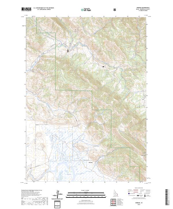
2024 Map of Herman
USGS Topo · Published 2024About this map
Herman lies at the heart of this mountain landscape, situated at the eastern edge of the Grays Lake National Wildlife Refuge. The terrain is defined by the high ridges of the Caribou Range and the marshy expanses of Grays Lake and its Grays Lake Outlet. In the northern half of the region, the Caribou National Forest covers the highlands where Sawmill Creek, Corral Creek, and Bear Creek descend toward the valley floor. The transport network reflects a history of high-altitude passage, with the Herman-McCoy road and numerous backcountry routes like the McCoy Pole Trl and Spring Creek Trl connecting Della Basin to the lower meadows. This 2024 survey captures the persistence of these rural mountain settlements and the carefully managed habitats of Outlet Valley.
Find a feature on this map
33 named features on this map. Tap any name to fly to it.
Don’t see what you’re looking for? This feature index may not catch every label — zoom into the map to look around manually.
Map Details
Editions of this 2024 Herman Map
This is the sole edition of this map. No revisions or reprints were ever made.
Other maps of this area

1917 · Cranes Flat
USGS Topo · 1:62,500

1924 · Hell Creek
USGS Topo · 1:62,500

1926 · Hell Creek
USGS Topo · 1:62,500

1932 · Irwin
USGS Topo · 1:96,000

1935 · Irwin
USGS Topo · 1:125,000

1955 · Driggs
USGS Topo · 1:250,000

1958 · Driggs
USGS Topo · 1:250,000

1962 · Driggs
USGS Topo · 1:250,000
1966 · Bear Island
USGS Topo · 1:24,000

1966 · Big Elk Mtn
USGS Topo · 1:24,000