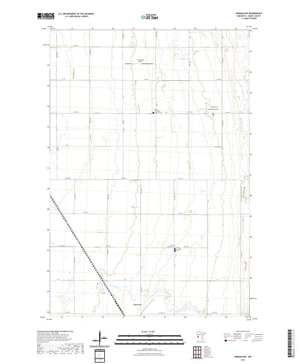
2022 Map of Herman NW
USGS Topo · Published 2022About this map
Norcross sits in the southwestern corner of this survey, established along the Mustinka River as a local center for the agricultural surrounding plains. The landscape is defined by a rigid section-line road network, including corridors like Co HWY 1 and Co HWY 8, which link the town to outlying farms and specialized sites like the Carlson Ag Airport and Ricks Field. Genealogists will find significant local history preserved at several burial grounds, including the Sigdal Norwegian Lutheran Cem, Norcross Lutheran Cem, and the Gorton Township Cem. The map illustrates the persistent intersection of pioneer-era heritage and modern rural infrastructure, where century-old churchyards remain as landmarks within a landscape of active contemporary aviation and large-scale farming.
Find a feature on this map
41 named features on this map. Tap any name to fly to it.
Don’t see what you’re looking for? This feature index may not catch every label — zoom into the map to look around manually.
Map Details
Editions of this 2022 Herman NW Map
This is the sole edition of this map. No revisions or reprints were ever made.
Other maps of this area

1910 · Wendell
USGS Topo · 1:62,500

1911 · Herman
USGS Topo · 1:62,500

1913 · Wendell
USGS Topo · 1:62,500

1951 · Wheaton
USGS Topo · 1:62,500

1951 · Campbell
USGS Topo · 1:62,500

1953 · Milbank
USGS Topo · 1:250,000

1953 · Fargo
USGS Topo · 1:250,000

1956 · Fargo
USGS Topo · 1:250,000

1958 · Milbank
USGS Topo · 1:250,000

1973 · Herman NW
USGS Topo · 1:24,000