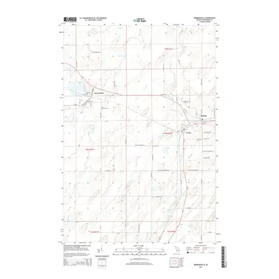
2014 Map of Hermansville
USGS Topo · Published 2014About this map
Hermansville, Spalding, and Powers form a tight cluster of settlements along the historic Us-2 corridor in the Upper Peninsula. This area is defined by its relationship with water and industry, where the Little Cedar River and Cedar River wind through the landscape. The layout of Hermansville itself, with streets like Railroad St and its proximity to Hermansville Lake, reflects the town's roots in the timber and transport sectors that built Menominee County.
Find a feature on this map
75 named features on this map. Tap any name to fly to it.
Don’t see what you’re looking for? This feature index may not catch every label — zoom into the map to look around manually.
Map Details
Editions of this 2014 Hermansville Map
This is the sole edition of this map. No revisions or reprints were ever made.
Other maps of this area

1954 · Escanaba
USGS Topo · 1:250,000

1956 · Foster City
USGS Topo · 1:62,500

1957 · Escanaba
USGS Topo · 1:250,000

1958 · Escanaba
USGS Topo · 1:250,000

1963 · Bark River
USGS Topo · 1:62,500

1963 · Powers
USGS Topo · 1:62,500

1963 · Schaffer
USGS Topo · 1:62,500

1982 · Escanaba
USGS Topo · 1:100,000
1986 · Waucedah
USGS Topo · 1:24,000
1986 · Vega
USGS Topo · 1:24,000