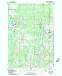
1989 Map of Hermansville
USGS Topo · Published 1989About this map
The timber and transit history of Menominee County is anchored here by the tri-settlement cluster of Hermansville, Spalding, and Powers. This landscape is defined by its industrial rail heritage, where the Soo Line, C and N W Ry, and the E and L S RR converge. The abundance of wetlands and water features, including Beaver Dam Creek and the West Branch Cedar River, reflects the geography that once supported the region's logging era. Local heritage is preserved at Meyer Cem and Spalding Cem, while the industrial footprint is visible through numerous Gravel Pits and the prominence of the Spalding Lookout Tower. From the shores of Hermansville Lake to the southern reaches of Kloman Lake, this survey documents the late 20th-century character of these Upper Peninsula townships.
Find a feature on this map
33 named features on this map. Tap any name to fly to it.
Don’t see what you’re looking for? This feature index may not catch every label — zoom into the map to look around manually.
Map Details
Editions of this 1989 Hermansville Map
This is the sole edition of this map. No revisions or reprints were ever made.
Other maps of this area

1954 · Escanaba
USGS Topo · 1:250,000

1956 · Foster City
USGS Topo · 1:62,500

1957 · Escanaba
USGS Topo · 1:250,000

1958 · Escanaba
USGS Topo · 1:250,000

1963 · Bark River
USGS Topo · 1:62,500

1963 · Powers
USGS Topo · 1:62,500

1963 · Schaffer
USGS Topo · 1:62,500

1982 · Escanaba
USGS Topo · 1:100,000
1986 · Waucedah
USGS Topo · 1:24,000
1986 · Vega
USGS Topo · 1:24,000