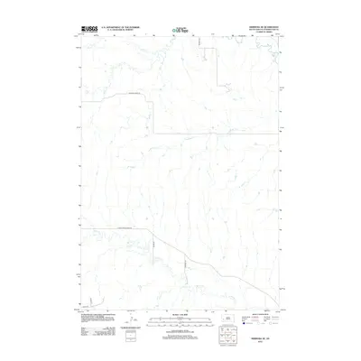
2012 Map of Hermosa NE
USGS Topo · Published 2012About this map
Spring Cr and Antelope Cr define the hydrological character of this Pennington County landscape, cutting through the terrain alongside the smaller drainage of Dry Cr. The map captures a transition in the rural infrastructure of the Black Hills foothills during the early twenty-first century, where established routes like Bradsky Rd and Antelope Creek Rd provide the primary access through the plains. The southern portion of the sheet is marked by the course of Spring Cr, which is paralleled by Lower Spring Creek Rd and intersected by more recent developments such as Marge Ct and Dewey Ln. This alignment of watercourses and roads reflects the enduring importance of natural drainages in guiding the development of the local transportation network in western South Dakota.
Find a feature on this map
11 named features on this map. Tap any name to fly to it.
Don’t see what you’re looking for? This feature index may not catch every label — zoom into the map to look around manually.
Map Details
Editions of this 2012 Hermosa NE Map
This is the sole edition of this map. No revisions or reprints were ever made.
Other maps of this area

1893 · Rapid
USGS Topo · 1:125,000

1894 · Hermosa
USGS Topo · 1:125,000

1898 · Rapid
USGS Topo · 1:125,000

1901 · Hermosa
USGS Topo · 1:125,000

1903 · Rapid
USGS Topo · 1:125,000

1953 · Boxelder
USGS Topo · 1:24,000

1953 · Hermosa NW
USGS Topo · 1:24,000

1953 · Rapid City East
USGS Topo · 1:24,000

1953 · Hermosa
USGS Topo · 1:24,000

1953 · New Underwood SW
USGS Topo · 1:24,000