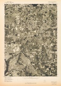
1976 Map of Hersperia SE
USGS Topo · Published 1976About this map
Hesperia serves as the primary hub of this aerial survey, appearing as a concentrated grid of development along the meanders of the White River. Captured in the mid-1970s, this orthophotograph reveals a landscape defined by a stark contrast between dense woodlots and rectangular agricultural clearings. The winding river corridor acts as a natural spine for the region, cutting through the geometric patterns of rural section lines. This specific format of map, an advance print orthophotoquad, provides a direct visual of the land surface as it appeared on May 8, 1976, showing the exact footprint of farms and the internal layout of the village before later decades of expansion or reforestation. The imagery captures the transition from town to country, where the residential streets of Hesperia give way to the large-scale farm plots that characterize this portion of Oceana County.
Find a feature on this map
1 named feature on this map. Tap any name to fly to it.
Don’t see what you’re looking for? This feature index may not catch every label — zoom into the map to look around manually.
Map Details
Editions of this 1976 Hersperia SE Map
This is the sole edition of this map. No revisions or reprints were ever made.
Other maps of this area

1931 · Walkerville NE
USGS Topo · 1:31,680

1931 · Walkerville SW
USGS Topo · 1:31,680

1931 · Walkerville NW
USGS Topo · 1:31,680

1931 · Walkerville SE
USGS Topo · 1:31,680

1954 · Milwaukee
USGS Topo · 1:250,000

1954 · Midland
USGS Topo · 1:250,000

1958 · Midland
USGS Topo · 1:250,000

1958 · Milwaukee
USGS Topo · 1:250,000

1958 · Hesperia
USGS Topo · 1:62,500

1958 · Twin Lake
USGS Topo · 1:62,500