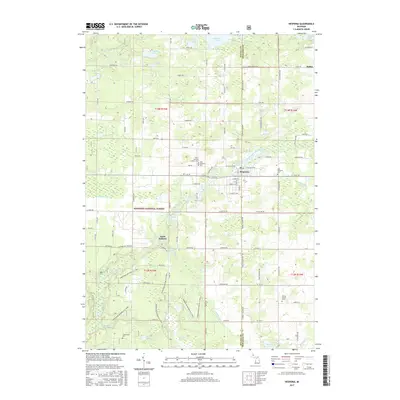
2017 Map of Hesperia
USGS Topo · Published 2017About this map
Hesperia serves as the focal point of this survey, straddling the line between Oceana and Newaygo Counties at the confluence of the South Branch White River and Hesperia Pond. The landscape is a mosaic of public timberlands and family farmsteads, with much of the southern and western portions falling within the Manistee National Forest. This era shows a well-distributed network of rural burials and small crossroads, including the Christ the King Catholic Cem, West Hesperia Cem, and East Hesperia Cem. To the south, the terrain becomes increasingly wetland-oriented near the Cushman Swamp and Lost Lake. The small settlement of Saint Huberts and the community at Huber reflect the scattered residential patterns of the Michigan forest country. Numerous waterways like Cushman Cr and Branton Drain illustrate the natural drainage systems that have historically defined property lines and land use in this region.
Find a feature on this map
73 named features on this map. Tap any name to fly to it.
Don’t see what you’re looking for? This feature index may not catch every label — zoom into the map to look around manually.
Map Details
Editions of this 2017 Hesperia Map
This is the sole edition of this map. No revisions or reprints were ever made.
Other maps of this area

1931 · Walkerville NE
USGS Topo · 1:31,680

1931 · Walkerville SW
USGS Topo · 1:31,680

1931 · Walkerville NW
USGS Topo · 1:31,680

1931 · Walkerville SE
USGS Topo · 1:31,680

1954 · Milwaukee
USGS Topo · 1:250,000

1954 · Midland
USGS Topo · 1:250,000

1958 · Midland
USGS Topo · 1:250,000

1958 · Milwaukee
USGS Topo · 1:250,000

1958 · Hesperia
USGS Topo · 1:62,500

1958 · Twin Lake
USGS Topo · 1:62,500