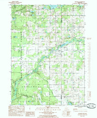
1985 Map of Hesperia
USGS Topo · Published 1985About this map
The village of Hesperia straddles the line between Newaygo and Oceana counties, anchored by the waters of Hesperia Pond and the South Branch White River. This mid-1980s survey captures a landscape defined by its glaciated hydrology and early industrial legacy, featuring a dense network of lakes such as McLaren Lake, Winters Lake, and Darlington Lake. The terrain transitions from the developed streets of the village into the protected lands of the Manistee National Forest to the west.
Find a feature on this map
35 named features on this map. Tap any name to fly to it.
Don’t see what you’re looking for? This feature index may not catch every label — zoom into the map to look around manually.
Map Details
Editions of this 1985 Hesperia Map
This is the sole edition of this map. No revisions or reprints were ever made.
Other maps of this area

1931 · Walkerville NE
USGS Topo · 1:31,680

1931 · Walkerville SW
USGS Topo · 1:31,680

1931 · Walkerville NW
USGS Topo · 1:31,680

1931 · Walkerville SE
USGS Topo · 1:31,680

1954 · Milwaukee
USGS Topo · 1:250,000

1954 · Midland
USGS Topo · 1:250,000

1958 · Midland
USGS Topo · 1:250,000

1958 · Milwaukee
USGS Topo · 1:250,000

1958 · Hesperia
USGS Topo · 1:62,500

1958 · Twin Lake
USGS Topo · 1:62,500