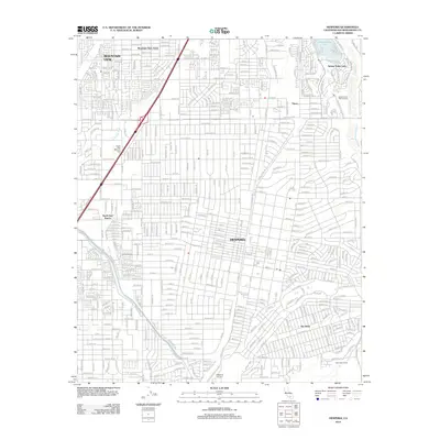
2012 Map of Hesperia
USGS Topo · Published 2012About this map
Hesperia is shown here at a moment of significant suburban expansion into the High Desert, defined by its dense residential grid spreading between the Mojave River and the high-speed corridor of I-15. The map documents a complex water management and transport system, featuring the Governor Edmund G Brown California Aqueduct cutting diagonally across the landscape and the Oro Grande Wash snaking through the western neighborhoods. Local aviation and industry are represented by the Hesperia Airport and the Mojave State Fish Hatchery, while established communities like Mountain View Acres and Spring Valley Lake provide a clear view of the area's mid-century and late-century residential developments. Cultural landmarks such as Desert View Memorial Park and local holdings like North Star Ranch and Herrington Ranch offer specific points of interest for those tracing the modern footprint of these desert settlements.
Find a feature on this map
16 named features on this map. Tap any name to fly to it.
Don’t see what you’re looking for? This feature index may not catch every label — zoom into the map to look around manually.
Map Details
Editions of this 2012 Hesperia Map
This is the sole edition of this map. No revisions or reprints were ever made.
Other maps of this area

1901 · Southern California Sheet No. 1
USGS Topo · 1:250,000

1902 · Deep Creek
USGS Topo · 1:62,500

1902 · Hesperia
USGS Topo · 1:62,500

1904 · Southern California Sheet No. 1
USGS Topo · 1:250,000

1932 · Barstow
USGS Topo · 1:125,000

1934 · Barstow
USGS Topo · 1:125,000

1942 · Hesperia
USGS Topo · 1:62,500

1953 · San Bernardino
USGS Topo · 1:250,000

1956 · San Bernardino
USGS Topo · 1:250,000
1956 · Cajon
USGS Topo · 1:24,000