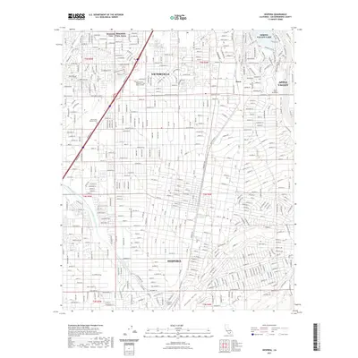
2021 Map of Hesperia
USGS Topo · Published 2021About this map
Victorville and Hesperia occupy this high-desert landscape, where the built environment of the Victor Valley meets the natural path of the Mojave River. The map shows a sophisticated infrastructure for water management, most notably the Governor Edmund G Brown East Branch California Aqueduct and the Oro Grande Wash, which define the drainage patterns of the region. Educational and recreational hubs are well-established, including the Victor Valley College campus and the planned community around Spring Valley Lake.
Find a feature on this map
26 named features on this map. Tap any name to fly to it.
Don’t see what you’re looking for? This feature index may not catch every label — zoom into the map to look around manually.
Map Details
Editions of this 2021 Hesperia Map
This is the sole edition of this map. No revisions or reprints were ever made.
Other maps of this area

1901 · Southern California Sheet No. 1
USGS Topo · 1:250,000

1902 · Deep Creek
USGS Topo · 1:62,500

1902 · Hesperia
USGS Topo · 1:62,500

1904 · Southern California Sheet No. 1
USGS Topo · 1:250,000

1932 · Barstow
USGS Topo · 1:125,000

1934 · Barstow
USGS Topo · 1:125,000

1942 · Hesperia
USGS Topo · 1:62,500

1953 · San Bernardino
USGS Topo · 1:250,000

1956 · San Bernardino
USGS Topo · 1:250,000
1956 · Cajon
USGS Topo · 1:24,000