1902 Map of Hesperia
USGS Topo · Published 1902About this map
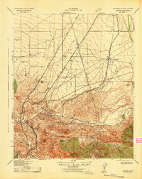
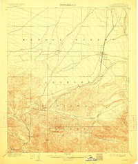
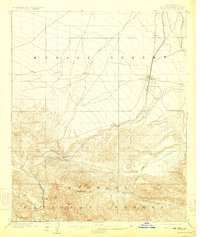
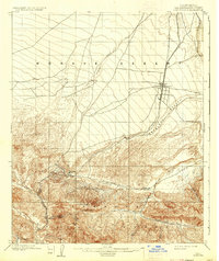
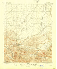
The Southern California railroad route serves as the central artery through this landscape at the turn of the century, climbing from the coastal basins toward the Mohave Desert through the critical gap of Cajon Pass. This topographical study reveals the early infrastructure and named landmarks of the region's steep transition, featuring the tiny settlement of Hesperia and the high point at Summit. The map distinguishes between the San Gabriel Timber Reserve and the San Bernardino Forest Reserve, reflecting early federal land management in the mountains. Local land use is evidenced by several remote outposts, including Burcham Ranch, Applewhite Ranch, and Cosy Dell, situated along the rugged drainage of Cajon Canyon and the West Fork. These family-named locations provide valuable points of reference for genealogists tracking early desert-edge settlers and ranching operations.
Find a feature on this map
23 named features on this map. Tap any name to fly to it.
Don’t see what you’re looking for? This feature index may not catch every label — zoom into the map to look around manually.
Map Details
Editions of this 1902 Hesperia Map
6 editions found
Historical Maps of Sunset Ridge Through Time
4 maps found