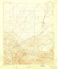
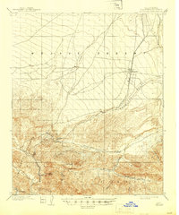
1902 Map of Hesperia
USGS Topo · Published 1923About this map
Cajon Pass serves as the focal point of this turn-of-the-century landscape, marking the critical transition between the southern mountains and the high desert. The Southern California Railway snakes through the pass, following the corridor from Summit toward the developing railroad town of Hesperia. This infrastructure represents the lifeline of early 20th-century San Bernardino County, connecting the coastal basins to the interior through this narrow gateway.
Find a feature on this map
21 named features on this map. Tap any name to fly to it.
Don’t see what you’re looking for? This feature index may not catch every label — zoom into the map to look around manually.
Map Details
Editions of this 1902 Hesperia Map
6 editions found
Other maps of this area

1896 · San Bernardino
USGS Topo · 1:62,500

1897 · Cucamonga
USGS Topo · 1:62,500

1898 · San Bernardino
USGS Topo · 1:62,500

1899 · Redlands
USGS Topo · 1:62,500

1900 · Cucamonga
USGS Topo · 1:62,500

1901 · Southern California Sheet No. 1
USGS Topo · 1:250,000

1901 · San Bernardino
USGS Topo · 1:62,500

1901 · Redlands
USGS Topo · 1:62,500

1902 · Deep Creek
USGS Topo · 1:62,500

1902 · Hesperia
USGS Topo · 1:62,500