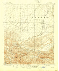
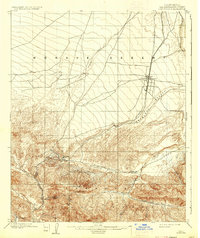
1902 Map of Hesperia
USGS Topo · Published 1945About this map
The California Southern R. R. cuts a precise path through this high desert landscape, marking the critical transportation corridor at the turn of the century. This survey, conducted by R. U. Goode and his team, documents the transition from the arid expanse of the Mojave Desert and Antelope Valley into the steep rises of the San Gabriel Mountains. The strategic importance of Cajon Pass is evident, serving as the gateway between the desert floor and the coastal basins.
Find a feature on this map
22 named features on this map. Tap any name to fly to it.
Don’t see what you’re looking for? This feature index may not catch every label — zoom into the map to look around manually.
Map Details
Editions of this 1902 Hesperia Map
6 editions found
Other maps of this area

1896 · San Bernardino
USGS Topo · 1:62,500

1897 · Cucamonga
USGS Topo · 1:62,500

1898 · San Bernardino
USGS Topo · 1:62,500

1899 · Redlands
USGS Topo · 1:62,500

1900 · Cucamonga
USGS Topo · 1:62,500

1901 · Southern California Sheet No. 1
USGS Topo · 1:250,000

1901 · San Bernardino
USGS Topo · 1:62,500

1901 · Redlands
USGS Topo · 1:62,500

1902 · Deep Creek
USGS Topo · 1:62,500

1902 · Hesperia
USGS Topo · 1:62,500