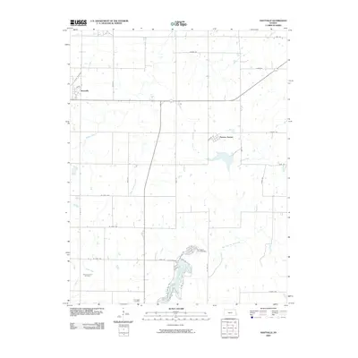
2009 Map of Hiattville
USGS Topo · Published 2009About this map
Hiattville and Pawnee Station anchor this rural Bourbon County landscape, where agriculture and resource extraction meet the headwaters of several regional creeks. The township is defined by a rigorous section-line grid, though the natural courses of Pawnee Creek and Elm Creek disrupt the geometry of the road network. To the south, the Farlington Fish Hatchery sits adjacent to the sprawling waters of Farlington Lake, providing a distinct industrial-natural hybrid at the edge of the Farlington Cemetery.
Find a feature on this map
39 named features on this map. Tap any name to fly to it.
Don’t see what you’re looking for? This feature index may not catch every label — zoom into the map to look around manually.
Map Details
Editions of this 2009 Hiattville Map
This is the sole edition of this map. No revisions or reprints were ever made.
Other maps of this area

1884 · Fort Scott
USGS Topo · 1:125,000

1886 · Fort Scott
USGS Topo · 1:125,000

1893 · Fort Scott
USGS Topo · 1:125,000

1947 · Joplin
USGS Topo · 1:250,000

1948 · Mulberry
USGS Topo · 1:62,500

1948 · Girard
USGS Topo · 1:62,500
1949 · Girard
USGS Topo · 1:62,500

1949 · Joplin
USGS Topo · 1:250,000
1950 · Mulberry
USGS Topo · 1:62,500

1954 · Joplin
USGS Topo · 1:250,000