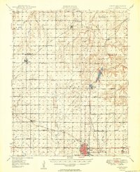
1949 Map of Girard
USGS Topo · Published 1949About this map
Girard serves as the focal point of this Kansas landscape, situated at the junction of the St Louis and San Francisco and the Atchison Topeka and Santa Fe railroads. The late 1940s topography reveals a dense network of rural one-room schoolhouses, such as Prairie Bell Sch and Fair Oak Sch, which anchored the agricultural townships before mid-century consolidation. These institutions, alongside numerous family cemeteries like Spangler Cem and Mills Cem, highlight the established social fabric of Crawford Co and Bourbon Co.
Find a feature on this map
65 named features on this map. Tap any name to fly to it.
Don’t see what you’re looking for? This feature index may not catch every label — zoom into the map to look around manually.
Map Details
Editions of this 1949 Girard Map
2 editions found
Other maps of this area

1884 · Fort Scott
USGS Topo · 1:125,000

1886 · Joplin
USGS Topo · 1:125,000

1886 · Iola
USGS Topo · 1:125,000

1886 · Fort Scott
USGS Topo · 1:125,000

1886 · Parsons
USGS Topo · 1:125,000

1893 · Fort Scott
USGS Topo · 1:125,000

1893 · Iola
USGS Topo · 1:125,000

1893 · Parsons
USGS Topo · 1:125,000

1894 · Joplin
USGS Topo · 1:125,000

1904 · Iola
USGS Topo · 1:125,000