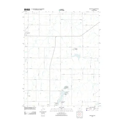
2012 Map of Hiattville
USGS Topo · Published 2012About this map
Hiattville and Pawnee Station anchor this rural Bourbon County landscape, where the grid of county roads meets the winding courses of Pawnee Cr and Little Pawnee Cr. The southern portion of the map is defined by the recreation and conservation efforts centered around Lake Crawford, which is bordered by several distinct camping areas including the Lonesome Point Campground and Osage Bluff Campground.
Find a feature on this map
49 named features on this map. Tap any name to fly to it.
Don’t see what you’re looking for? This feature index may not catch every label — zoom into the map to look around manually.
Map Details
Editions of this 2012 Hiattville Map
This is the sole edition of this map. No revisions or reprints were ever made.
Other maps of this area

1884 · Fort Scott
USGS Topo · 1:125,000

1886 · Fort Scott
USGS Topo · 1:125,000

1893 · Fort Scott
USGS Topo · 1:125,000

1947 · Joplin
USGS Topo · 1:250,000

1948 · Mulberry
USGS Topo · 1:62,500

1948 · Girard
USGS Topo · 1:62,500
1949 · Girard
USGS Topo · 1:62,500

1949 · Joplin
USGS Topo · 1:250,000
1950 · Mulberry
USGS Topo · 1:62,500

1954 · Joplin
USGS Topo · 1:250,000