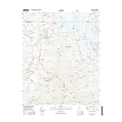
2014 Map of Hiawassee
USGS Topo · Published 2014About this map
Chatuge Lake dominates the northern landscape of this Southern Appalachian region, where the state line between Georgia and North Carolina meets the rugged ridges of the Chattahoochee National Forest. The settlement of Young Harris and the community of Hiawassee serve as primary hubs, connected by a network of state routes including Ga-17/75 and Us-76. The terrain is characterized by a dense concentration of named gaps and knobs, such as Mining Gap and Rattlesnake Knob, alongside numerous family-named coves like Swanson Cove and Bayless Cove. Local heritage is preserved in several small burial grounds, including the Old Union Cem and Woods Grove Memorial Cem. The mapping shows the intricate drainage systems of Brasstown Creek and its various forks, illustrating how early settlement patterns followed the narrow valley floors beneath heights like Swanson Mtn and Ramey Mtn.
Find a feature on this map
121 named features on this map. Tap any name to fly to it.
Don’t see what you’re looking for? This feature index may not catch every label — zoom into the map to look around manually.
Map Details
Editions of this 2014 Hiawassee Map
This is the sole edition of this map. No revisions or reprints were ever made.
Other maps of this area

1886 · Dahlonega
USGS Topo · 1:125,000

1892 · Dahlonega
USGS Topo · 1:125,000

1896 · Dahlonega
USGS Topo · 1:125,000

1903 · Dahlonega
USGS Topo · 1:125,000

1935 · Coosa Bald
USGS Topo · 1:24,000

1935 · Peachtree
USGS Topo · 1:24,000

1935 · Osborn
USGS Topo · 1:24,000

1935 · Shooting Creek
USGS Topo · 1:24,000

1935 · Wayah Bald
USGS Topo · 1:48,000

1935 · Tray Mountain
USGS Topo · 1:24,000