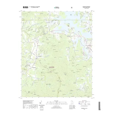
2020 Map of Hiawassee
USGS Topo · Published 2020About this map
Young Harris College serves as a central landmark in this mountain landscape, positioned just south of the border between Georgia and North Carolina. The terrain is characterized by a dense network of coves and ridges within the Chattahoochee National Forest, including Waterfall Cove and Big Bald Cove. The area shows a transition from the structured town center of Hiawassee, where the Towns County Courthouse stands, to the dispersed settlements of Friendship and Young Harris.
Find a feature on this map
212 named features on this map. Tap any name to fly to it.
Don’t see what you’re looking for? This feature index may not catch every label — zoom into the map to look around manually.
Map Details
Editions of this 2020 Hiawassee Map
This is the sole edition of this map. No revisions or reprints were ever made.
Other maps of this area

1886 · Dahlonega
USGS Topo · 1:125,000

1892 · Dahlonega
USGS Topo · 1:125,000

1896 · Dahlonega
USGS Topo · 1:125,000

1903 · Dahlonega
USGS Topo · 1:125,000

1935 · Coosa Bald
USGS Topo · 1:24,000

1935 · Peachtree
USGS Topo · 1:24,000

1935 · Osborn
USGS Topo · 1:24,000

1935 · Shooting Creek
USGS Topo · 1:24,000

1935 · Wayah Bald
USGS Topo · 1:48,000

1935 · Tray Mountain
USGS Topo · 1:24,000