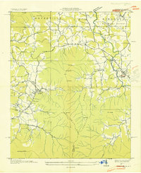
1935 Map of Hiawassee
USGS Topo · Published 1935About this map
The Hiwassee River corridor defines this mountain landscape along the border of Georgia and North Carolina during the mid-1930s. Centered on the town of Hiawassee, the area shows a transition from agricultural valley floor to the forested slopes of the Nantahala National Forest. The map documents a rural society built around small watercourses like Brasstown Creek and Hog Creek, where milling operations like Townsend Mill and a Mill Dam near Friendship were central to the local economy.
Find a feature on this map
61 named features on this map. Tap any name to fly to it.
Don’t see what you’re looking for? This feature index may not catch every label — zoom into the map to look around manually.
Map Details
Editions of this 1935 Hiawassee Map
This is the sole edition of this map. No revisions or reprints were ever made.
Other maps of this area

1886 · Dahlonega
USGS Topo · 1:125,000

1892 · Dahlonega
USGS Topo · 1:125,000

1896 · Dahlonega
USGS Topo · 1:125,000

1903 · Dahlonega
USGS Topo · 1:125,000

1935 · Coosa Bald
USGS Topo · 1:24,000

1935 · Peachtree
USGS Topo · 1:24,000

1935 · Osborn
USGS Topo · 1:24,000

1935 · Shooting Creek
USGS Topo · 1:24,000

1935 · Wayah Bald
USGS Topo · 1:48,000

1935 · Tray Mountain
USGS Topo · 1:24,000