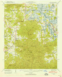
1941 Map of Hiawassee
USGS Topo · Published 1941About this map
Hiawassee and Young Harris sit at the northern edge of the Chattahoochee National Forest during this 1941 survey, illustrating a landscape defined by mountain ridges and the rising waters of the Tennessee Valley Authority system. Blue shading indicates areas slated for submergence by Hiwassee Lake (Chatuge Lake), which fundamentally altered the geography of the Brasstown Creek valley and surrounding coves. The map documents the rural infrastructure of Towns County before these changes, from the Townsend Mill near Jacksonville to family-centric landmarks like Burch Bridge.
Find a feature on this map
95 named features on this map. Tap any name to fly to it.
Don’t see what you’re looking for? This feature index may not catch every label — zoom into the map to look around manually.
Map Details
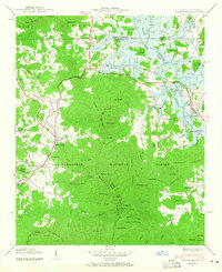
Editions of this 1941 Hiawassee Map
2 editions found
Other maps of this area

1886 · Dahlonega
USGS Topo · 1:125,000

1892 · Dahlonega
USGS Topo · 1:125,000

1896 · Dahlonega
USGS Topo · 1:125,000

1903 · Dahlonega
USGS Topo · 1:125,000

1935 · Coosa Bald
USGS Topo · 1:24,000

1935 · Peachtree
USGS Topo · 1:24,000

1935 · Osborn
USGS Topo · 1:24,000

1935 · Shooting Creek
USGS Topo · 1:24,000

1935 · Wayah Bald
USGS Topo · 1:48,000

1935 · Tray Mountain
USGS Topo · 1:24,000