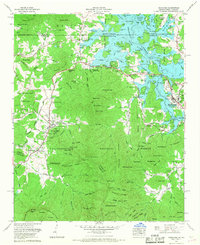
1966 Map of Hiawassee
USGS Topo · Published 1968About this map
Hiawassee and the sprawling waters of Chatuge Lake anchor this mid-1960s revision of the Blue Ridge mountain borderland. The landscape reflects a mix of institutional growth and preserved wilderness, centered on the campus of Young Harris College and the surrounding forests of the Nantahala National Forest and Chattahoochee National Forest. This era shows the developed recreation areas along the Hiwassee River following the creation of the reservoir, contrasted with the traditional rural life evidenced by numerous small cemeteries and remote gaps.
Find a feature on this map
105 named features on this map. Tap any name to fly to it.
Don’t see what you’re looking for? This feature index may not catch every label — zoom into the map to look around manually.
Map Details
Editions of this 1966 Hiawassee Map
This is the sole edition of this map. No revisions or reprints were ever made.
Other maps of this area

1886 · Dahlonega
USGS Topo · 1:125,000

1892 · Dahlonega
USGS Topo · 1:125,000

1896 · Dahlonega
USGS Topo · 1:125,000

1903 · Dahlonega
USGS Topo · 1:125,000

1935 · Coosa Bald
USGS Topo · 1:24,000

1935 · Peachtree
USGS Topo · 1:24,000

1935 · Osborn
USGS Topo · 1:24,000

1935 · Shooting Creek
USGS Topo · 1:24,000

1935 · Wayah Bald
USGS Topo · 1:48,000

1935 · Tray Mountain
USGS Topo · 1:24,000