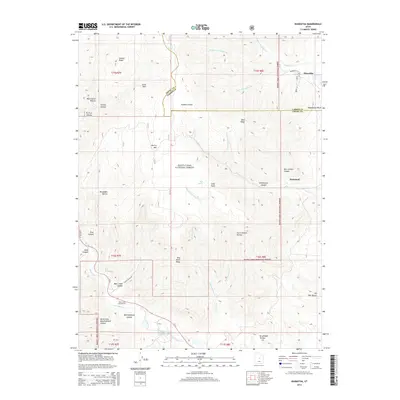
2014 Map of Hiawatha
USGS Topo · Published 2014About this map
Mohrland and Hiawatha sit at the eastern edge of this 2014 survey, marking a transition from the canyon floors to the high elevations of the Manti-LaSal National Forest. The map documents the complex drainage systems of the Wasatch Plateau, where the Left Fork Cedar Creek and Right Fork Cedar Creek converge near Huntington Canyon. High-altitude features like Gentry Mountain and Gentry Ridge dominate the western portion of the quadrangle, while Wild Horse Ridge and Bear Creek Canyon define the southern landscape. The presence of the Huntington Reservoir and the Bear Creek Campground indicates a landscape used for both water management and recreation. The county line between Emery and Carbon Counties snakes across the northern sections, cutting through named hollows such as Wild Cattle Hollow and McCadden Hollow, illustrating the political boundaries imposed on this high-desert terrain.
Find a feature on this map
54 named features on this map. Tap any name to fly to it.
Don’t see what you’re looking for? This feature index may not catch every label — zoom into the map to look around manually.
Map Details
Editions of this 2014 Hiawatha Map
This is the sole edition of this map. No revisions or reprints were ever made.
Other maps of this area

1885 · Manti
USGS Topo · 1:250,000

1886 · Price River
USGS Topo · 1:250,000

1895 · Manti
USGS Topo · 1:250,000

1896 · Price River
USGS Topo · 1:250,000

1914 · Castle Gate
USGS Topo · 1:62,500

1916 · Castle Gate
USGS Topo · 1:62,500

1923 · Scofield
USGS Topo · 1:62,500

1923 · Hiawatha
USGS Topo · 1:62,500

1925 · Scofield
USGS Topo · 1:62,500

1925 · Hiawatha
USGS Topo · 1:62,500