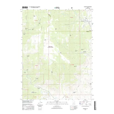
2017 Map of Hiawatha
USGS Topo · Published 2017About this map
Hiawatha and Mohrland anchor the rugged drainage systems of the Manti-Lasal National Forest along the border of Carbon and Emery counties. This landscape is defined by the high elevations of Gentry Mtn and Gentry Ridge, where the complex network of deep canyons like Huntington Canyon and Rilda Canyon channel water into the Huntington Creek system. The map records the infrastructure of the local coal mining legacy, with Black Hawk Mine Rd providing access to the steep slopes above the settlements. Local history is preserved at the Hiawatha Cem, while the industrial and agricultural needs of the region are reflected in the presence of the Huntington Reservoir and the numerous springs, such as Pine Spring and Mud Spring, that dot the high plateaus.
Find a feature on this map
54 named features on this map. Tap any name to fly to it.
Don’t see what you’re looking for? This feature index may not catch every label — zoom into the map to look around manually.
Map Details
Editions of this 2017 Hiawatha Map
This is the sole edition of this map. No revisions or reprints were ever made.
Other maps of this area

1885 · Manti
USGS Topo · 1:250,000

1886 · Price River
USGS Topo · 1:250,000

1895 · Manti
USGS Topo · 1:250,000

1896 · Price River
USGS Topo · 1:250,000

1914 · Castle Gate
USGS Topo · 1:62,500

1916 · Castle Gate
USGS Topo · 1:62,500

1923 · Scofield
USGS Topo · 1:62,500

1923 · Hiawatha
USGS Topo · 1:62,500

1925 · Scofield
USGS Topo · 1:62,500

1925 · Hiawatha
USGS Topo · 1:62,500