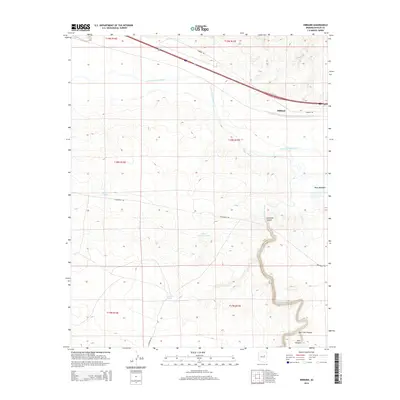
2014 Map of Hibbard
USGS Topo · Published 2014About this map
Hibbard sits near the northern edge of this high-desert landscape, where the Little Colorado River winds through Navajo County. The topography is defined by the dramatic incision of Chevelon Canyon as it carries Chevelon Creek northward. This 2014 survey reveals a sparse network of ranching infrastructure and remote access routes like Territorial Rd and Lightening Rd. Water management is central to the area's utility, evidenced by scattered improvements such as Bottom Tank, Little Chevelon Tank, and Chevelon Tank. To the southeast, the terrain transitions into complex drainage systems, including Bell Cow Canyon and Deer Canyon. This map provides a clear view of the arid eastern Arizona landscape, showing how modern transportation routes like Hibbard Rd parallel the natural path of the river while navigating the breaks and plateaus of Hugo Meadows.
Find a feature on this map
20 named features on this map. Tap any name to fly to it.
Don’t see what you’re looking for? This feature index may not catch every label — zoom into the map to look around manually.
Map Details
Editions of this 2014 Hibbard Map
This is the sole edition of this map. No revisions or reprints were ever made.
Other maps of this area

1883 · Tusayan
USGS Topo · 1:250,000

1886 · Tusayan
USGS Topo · 1:250,000

1886 · Holbrook
USGS Topo · 1:250,000

1893 · Holbrook
USGS Topo · 1:250,000

1947 · Flagstaff
USGS Topo · 1:250,000

1954 · Winslow
USGS Topo · 1:62,500

1954 · Winslow 4 SW
USGS Topo · 1:24,000

1954 · Winslow 4 SE
USGS Topo · 1:24,000

1954 · Flagstaff
USGS Topo · 1:250,000

1954 · Holbrook
USGS Topo · 1:250,000