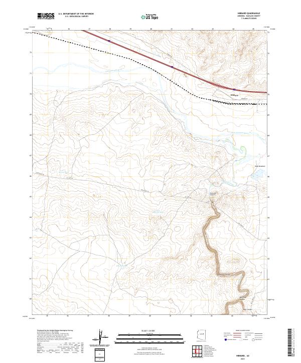
2021 Map of Hibbard
USGS Topo · Published 2021About this map
Hibbard serves as a focal point in this high-desert landscape, situated where transportation corridors cross the drainage of the Little Colorado River. The terrain is defined by the significant incision of Chevelon Canyon and its tributaries, including Bell Cow Canyon and Deer Canyon, which cut through the arid plains of Navajo County. Water management is a primary feature of the local geography, evidenced by several artificial catchments such as Bottom Tank, Little Chevelon Tank, and Chevelon Tank. These features suggest a landscape organized for cattle ranching, where seasonal water sources are vital for livestock in the open range. In the eastern portion of the map, Hugo Meadows provides a distinct break from the canyon topography, while the course of Chevelon Creek (labeled in parts as Chevelon Cr) winds northward to join the river. This survey captures the sparse infrastructure of the region, including the paths of Territorial Rd and Mc Laws Rd.
Find a feature on this map
21 named features on this map. Tap any name to fly to it.
Don’t see what you’re looking for? This feature index may not catch every label — zoom into the map to look around manually.
Map Details
Editions of this 2021 Hibbard Map
This is the sole edition of this map. No revisions or reprints were ever made.
Other maps of this area

1883 · Tusayan
USGS Topo · 1:250,000

1886 · Tusayan
USGS Topo · 1:250,000

1886 · Holbrook
USGS Topo · 1:250,000

1893 · Holbrook
USGS Topo · 1:250,000

1947 · Flagstaff
USGS Topo · 1:250,000

1954 · Winslow
USGS Topo · 1:62,500

1954 · Winslow 4 SW
USGS Topo · 1:24,000

1954 · Winslow 4 SE
USGS Topo · 1:24,000

1954 · Flagstaff
USGS Topo · 1:250,000

1954 · Holbrook
USGS Topo · 1:250,000