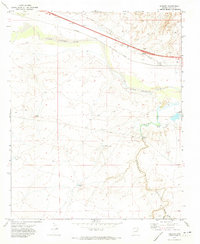
1970 Map of Hibbard
USGS Topo · Published 1973About this map
The Atchison Topeka and Santa Fe railroad corridor dominates the northern landscape of this Navajo County region, running parallel to the Little Colorado River. This transit-heavy section of the high desert centers on the small settlement of Hibbard, where the rail line meets Hibbard Rd at the Hibbard Interchange. The map illustrates the critical infrastructure required to manage water in this arid environment, featuring the Chevelon Aqueduct, a Pumping Station, and numerous catchment points like Little Chevelon Tank and Chevelon Tank.
Find a feature on this map
23 named features on this map. Tap any name to fly to it.
Don’t see what you’re looking for? This feature index may not catch every label — zoom into the map to look around manually.
Map Details
Editions of this 1970 Hibbard Map
This is the sole edition of this map. No revisions or reprints were ever made.
Other maps of this area

1883 · Tusayan
USGS Topo · 1:250,000

1886 · Tusayan
USGS Topo · 1:250,000

1886 · Holbrook
USGS Topo · 1:250,000

1893 · Holbrook
USGS Topo · 1:250,000

1947 · Flagstaff
USGS Topo · 1:250,000

1954 · Winslow
USGS Topo · 1:62,500

1954 · Winslow 4 SW
USGS Topo · 1:24,000

1954 · Winslow 4 SE
USGS Topo · 1:24,000

1954 · Flagstaff
USGS Topo · 1:250,000

1954 · Holbrook
USGS Topo · 1:250,000