
1959 Map of Hickok NE
USGS Topo · Published 1961About this map
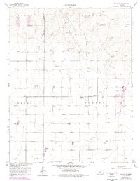
Pleasant Prairie Oil Field dominates the landscape of this Southwestern Kansas quadrangle, where the expansive grid of the High Plains is marked by dozens of individual gas and oil wells. The map captures a moment of transition from purely agricultural use to industrial energy production, as evidenced by the dense cluster of Gas Wells that pepper the townships of Dudley and Sherman. Despite this industrial overlay, the traditional social fabric of the area remains anchored by local institutions like the Pleasant Prairie Ch and the Pleasant Prairie Sch, located at a central crossroads.
Find a feature on this map
13 named features on this map. Tap any name to fly to it.
Don’t see what you’re looking for? This feature index may not catch every label — zoom into the map to look around manually.
Map Details
Editions of this 1959 Hickok NE Map
2 editions found
Other maps of this area

1891 · Larned
USGS Topo · 1:125,000

1896 · Garden
USGS Topo · 1:125,000

1900 · Lakin
USGS Topo · 1:125,000

1955 · Dodge City
USGS Topo · 1:250,000

1958 · Dodge City
USGS Topo · 1:250,000

1959 · Dodge City
USGS Topo · 1:250,000

1959 · Hickok NW
USGS Topo · 1:24,000

1959 · Hickok
USGS Topo · 1:24,000

1959 · Garden City 3 NW
USGS Topo · 1:24,000

1960 · Hickok SE
USGS Topo · 1:24,000