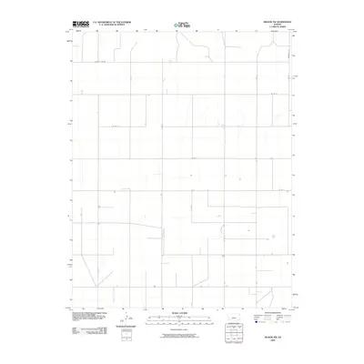
2009 Map of Hickok NW
USGS Topo · Published 2009About this map
County Line Rd and Deerfield Ln define the structured grid of this agricultural landscape in Grant County during the late 2000s. The terrain is characterized by a precise network of arterial paths including N Rd R and N Rd V, which facilitate access across the vast open sections of this Kansas township. The map depicts a period when rural infrastructure was heavily reliant on these section-line routes, such as Co Rd 3 and Co Rd 4, to connect isolated farmsteads and agricultural operations. This survey reflects the enduring Jeffersonian grid system, where the layout of transport remains largely unchanged over decades, preserving the traditional spatial organization of the Great Plains. The sparse placement of structures alongside routes like Co Rd 5 emphasizes the large-scale land use patterns typical of this region's modern farming era.
Find a feature on this map
13 named features on this map. Tap any name to fly to it.
Don’t see what you’re looking for? This feature index may not catch every label — zoom into the map to look around manually.
Map Details
Editions of this 2009 Hickok NW Map
This is the sole edition of this map. No revisions or reprints were ever made.
Other maps of this area

1891 · Larned
USGS Topo · 1:125,000

1900 · Lakin
USGS Topo · 1:125,000

1955 · Dodge City
USGS Topo · 1:250,000

1958 · Dodge City
USGS Topo · 1:250,000

1959 · Dodge City
USGS Topo · 1:250,000

1959 · Ulysses
USGS Topo · 1:24,000

1959 · Ulysses NE
USGS Topo · 1:24,000

1959 · Hickok NW
USGS Topo · 1:24,000

1959 · Hickok
USGS Topo · 1:24,000

1959 · Hickok NE
USGS Topo · 1:24,000