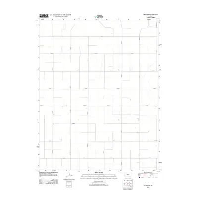
2012 Map of Hickok NW
USGS Topo · Published 2012About this map
Sherman Township in the early 21st century is defined by the rigid precision of the Public Land Survey System, where a sprawling grid of rural corridors facilitates agricultural movement across the high plains. The landscape is structured by a series of north-south routes including N Road Q, N Road S, and N Road U, intersected at mile intervals by east-west thoroughfares such as E Road 2 and E Road 6. This systematic layout reveals the industrial scale of modern farming in Grant County, where the occasional isolated structure or irrigation feature punctuates the expanse. Along the northern boundary, Co Line Rd serves as a jurisdictional marker, while Deerfield Ln hints at local connections to neighboring settlements. The map illustrates a region where transportation and land use are inextricably linked, preserving the geometric order established over a century prior.
Find a feature on this map
17 named features on this map. Tap any name to fly to it.
Don’t see what you’re looking for? This feature index may not catch every label — zoom into the map to look around manually.
Map Details
Editions of this 2012 Hickok NW Map
This is the sole edition of this map. No revisions or reprints were ever made.
Other maps of this area

1891 · Larned
USGS Topo · 1:125,000

1900 · Lakin
USGS Topo · 1:125,000

1955 · Dodge City
USGS Topo · 1:250,000

1958 · Dodge City
USGS Topo · 1:250,000

1959 · Dodge City
USGS Topo · 1:250,000

1959 · Ulysses
USGS Topo · 1:24,000

1959 · Ulysses NE
USGS Topo · 1:24,000

1959 · Hickok NW
USGS Topo · 1:24,000

1959 · Hickok
USGS Topo · 1:24,000

1959 · Hickok NE
USGS Topo · 1:24,000