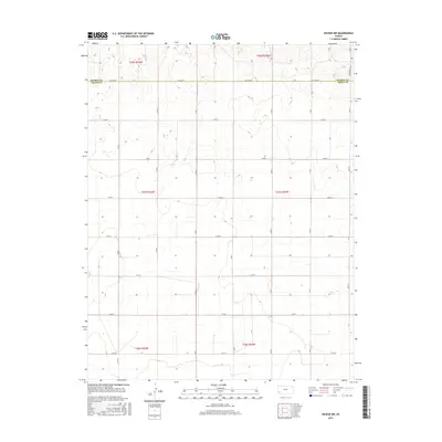
2015 Map of Hickok NW
USGS Topo · Published 2015About this map
Kearny Co and Grant Co meet along a perfectly straight boundary defined by Co Line Rd in this section of Southwest Kansas. The landscape is characterized by the rigid Public Land Survey System, where a precise grid of dirt and gravel routes like Co Rd 2 and N Rd S partition the high plains into section squares. This 2015 survey reflects the enduring agricultural geometry of the region, showing how contemporary infrastructure remains tied to nineteenth-century township lines. Sparse structures are scattered along these corridors, particularly near north-south arteries such as N Rd W and the eastern edge of the quadrangle along Deerfield Ln. The terrain is marked by subtle depressions and drainage patterns that interrupt the flat horizon, with the township divisions of T27S R36W and T27S R35W providing the primary geographic framework for local land tracts.
Find a feature on this map
24 named features on this map. Tap any name to fly to it.
Don’t see what you’re looking for? This feature index may not catch every label — zoom into the map to look around manually.
Map Details
Editions of this 2015 Hickok NW Map
This is the sole edition of this map. No revisions or reprints were ever made.
Other maps of this area

1891 · Larned
USGS Topo · 1:125,000

1900 · Lakin
USGS Topo · 1:125,000

1955 · Dodge City
USGS Topo · 1:250,000

1958 · Dodge City
USGS Topo · 1:250,000

1959 · Dodge City
USGS Topo · 1:250,000

1959 · Ulysses
USGS Topo · 1:24,000

1959 · Ulysses NE
USGS Topo · 1:24,000

1959 · Hickok NW
USGS Topo · 1:24,000

1959 · Hickok
USGS Topo · 1:24,000

1959 · Hickok NE
USGS Topo · 1:24,000