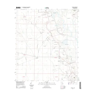
2015 Map of Hickory
USGS Topo · Published 2015About this map
West Pearl River and its intricate network of sloughs and bayous dominate the eastern landscape of this St. Tammany Parish survey. The river's influence on local life is evident in the water-bound features such as Doghead Island and Holmes Island, alongside the man-made Pearl River Canal. Settlement patterns are concentrated along the roadway corridors, connecting the communities of Hickory, Florenville, Audubon, and the northern edge of Pearl River. Genealogists will find a significant number of family and community burial sites scattered throughout the area, including Evans Creek Cem, Charter Oak Cem, and Henry-Talley Cem. The terrain is characterized by low-lying wetlands and hammocks, such as Pats Hammock and Mitchell Hammock, which shaped the placement of local thoroughfares like Archie Singletary Rd and Rheusaw Crawford Rd. The map provides a clear record of the intersection between the natural hydrology of the Pearl River basin and the rural development of the early 21st century.
Find a feature on this map
141 named features on this map. Tap any name to fly to it.
Don’t see what you’re looking for? This feature index may not catch every label — zoom into the map to look around manually.
Map Details
Editions of this 2015 Hickory Map
This is the sole edition of this map. No revisions or reprints were ever made.
Other maps of this area

1914 · Nicholson
USGS Topo · 1:62,500

1921 · Nicholson
USGS Topo · 1:62,500

1935 · Slidell
USGS Topo · 1:62,500

1939 · Slidell
USGS Topo · 1:62,500

1941 · Honey Island
USGS Topo · 1:31,680

1942 · Talisheek
USGS Topo · 1:31,680

1942 · Walkiah Bluff
USGS Topo · 1:31,680

1950 · Haaswood
USGS Topo · 1:31,680

1950 · Slidell
USGS Topo · 1:62,500

1953 · Mobile
USGS Topo · 1:250,000