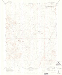
1971 Map of Hidden Valley Ranch
USGS Topo · Published 1974About this map
The Apishapa River carves a deep path through this high-plains landscape in Las Animas County, as seen in this early 1970s survey. The terrain is defined by dramatic breaks like Cordova Mesa and Black Bluff, transitioning into the expansive Tyrone Flats to the south. Water management for ranching and wildlife is central to the area's layout, evidenced by the Apishapa Game Management Area and a network of named water sources including Springer Well, Monroe Well, and Sulfur Well. Genealogists and local historians can locate the isolated Thorp Cem in the northeast and trace the roads leading to the Hidden Valley Ranch. The map also documents resource extraction efforts with several labeled sites like Sorgs and various drill holes scattered across the drainage of East Arroyo and Smith Hollow.
Find a feature on this map
34 named features on this map. Tap any name to fly to it.
Don’t see what you’re looking for? This feature index may not catch every label — zoom into the map to look around manually.
Map Details
Editions of this 1971 Hidden Valley Ranch Map
This is the sole edition of this map. No revisions or reprints were ever made.
Other maps of this area

1891 · Apishapa
USGS Topo · 1:125,000

1892 · Elmoro
USGS Topo · 1:125,000

1893 · Apishapa
USGS Topo · 1:125,000

1893 · Elmoro
USGS Topo · 1:125,000

1897 · Elmoro
USGS Topo · 1:125,000

1897 · Apishapa
USGS Topo · 1:125,000

1954 · Trinidad
USGS Topo · 1:250,000

1955 · Trinidad
USGS Topo · 1:250,000

1958 · Trinidad
USGS Topo · 1:250,000

1959 · Trinidad
USGS Topo · 1:250,000