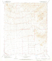
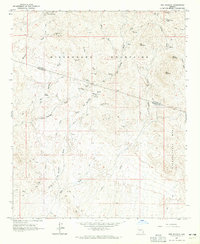
1965 Map of Hieroglyphic Mts. SW
USGS Topo · Published 1967About this map
The Hieroglyphic Mts. define the northeastern landscape of this mid-1960s desert survey, where steep topography transitions into an expansive alluvial plain. Arid-land habitation and water management are evident at English Camp and the nearby English Wells, illustrating the essential infrastructure required for survival in the Maricopa backcountry. The A T & S F railroad cuts across the southwestern corner, providing a vital transportation corridor through this remote territory. A network of Jeep Trails spiderwebs across the terrain, connecting isolated points like Nada and a solitary Grave located south of Padelford Wash. This map documents a period of transition where traditional desert outposts remained largely untouched by the encroaching modernization of the Phoenix basin to the southeast.
Find a feature on this map
9 named features on this map. Tap any name to fly to it.
Don’t see what you’re looking for? This feature index may not catch every label — zoom into the map to look around manually.
Map Details
Editions of this 1965 Hieroglyphic Mts. SW Map
3 editions found
Other maps of this area

1954 · Phoenix
USGS Topo · 1:250,000

1957 · Phoenix
USGS Topo · 1:250,000

1957 · White Tank Mts. NE
USGS Topo · 1:24,000

1957 · Calderwood Butte
USGS Topo · 1:24,000

1957 · McMicken Dam
USGS Topo · 1:24,000

1957 · White Tank Mts.
USGS Topo · 1:62,500

1958 · Phoenix
USGS Topo · 1:250,000

1960 · Phoenix
USGS Topo · 1:250,000
1964 · Garfias Mountain
USGS Topo · 1:24,000
1964 · Red Picacho
USGS Topo · 1:24,000