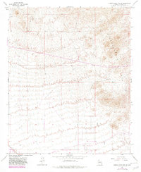
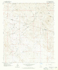
1965 Map of Hieroglyphic Mts. SW
USGS Topo · Published 1982About this map
The Wittmann settlement area and its arid surrounds are mapped here during a period of infrastructure expansion in central Arizona. While the southern portion of the sheet shows the development of a modern Canal system and established homestead locations like Nada, the northern reaches are dominated by the Hieroglyphic Mountains. Human presence in this environment is marked by isolated outposts such as English Wells and English Camp, and a solitary Grave recorded near a winding section of Padelford wash. This 1965 survey, updated with revisions from 1978, illustrates the contrast between the organized grid of the lowlands and the network of Jeep Trails that penetrate the high desert terrain.
Find a feature on this map
13 named features on this map. Tap any name to fly to it.
Don’t see what you’re looking for? This feature index may not catch every label — zoom into the map to look around manually.
Map Details
Editions of this 1965 Hieroglyphic Mts. SW Map
3 editions found
Other maps of this area

1954 · Phoenix
USGS Topo · 1:250,000

1957 · Phoenix
USGS Topo · 1:250,000

1957 · White Tank Mts. NE
USGS Topo · 1:24,000

1957 · Calderwood Butte
USGS Topo · 1:24,000

1957 · McMicken Dam
USGS Topo · 1:24,000

1957 · White Tank Mts.
USGS Topo · 1:62,500

1958 · Phoenix
USGS Topo · 1:250,000

1960 · Phoenix
USGS Topo · 1:250,000
1964 · Garfias Mountain
USGS Topo · 1:24,000
1964 · Red Picacho
USGS Topo · 1:24,000