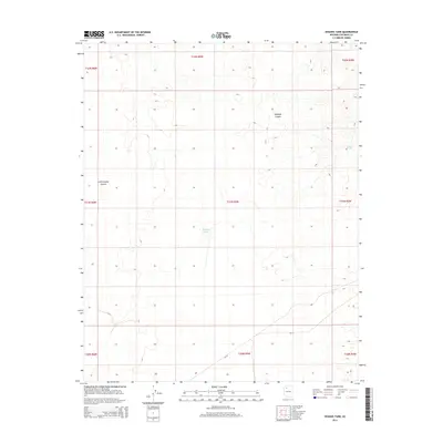
2014 Map of Higgins Tank
USGS Topo · Published 2014About this map
Hualapai Canyon and Little Coyote Canyon carve through this high desert landscape in Coconino County, where water is the primary driver of development. The presence of Higgins Tank and Jones Tank indicates the essential infrastructure required for ranching or land management in this arid region of Arizona. Transportation is minimal, defined by Bia-18 crossing the southern portion of the quadrangle. The map is primarily organized by the Public Land Survey System, showing several townships including t31n r5w and t32n r5w, which divide the terrain into a clear grid of sections. This survey provides a record of land use and water management within the tribal or federal lands of northern Arizona during the early 21st century.
Find a feature on this map
14 named features on this map. Tap any name to fly to it.
Don’t see what you’re looking for? This feature index may not catch every label — zoom into the map to look around manually.
Map Details
Editions of this 2014 Higgins Tank Map
This is the sole edition of this map. No revisions or reprints were ever made.
Other maps of this area
1886 · Chino
USGS Topo · 1:250,000
1886 · Kaibab
USGS Topo · 1:250,000
1891 · Chino
USGS Topo · 1:250,000
1948 · Williams
USGS Topo · 1:250,000

1953 · Grand Canyon
USGS Topo · 1:250,000
1954 · Williams
USGS Topo · 1:250,000
1956 · Williams
USGS Topo · 1:250,000

1957 · Grand Canyon
USGS Topo · 1:250,000

1958 · Grand Canyon
USGS Topo · 1:250,000
1960 · Williams
USGS Topo · 1:250,000