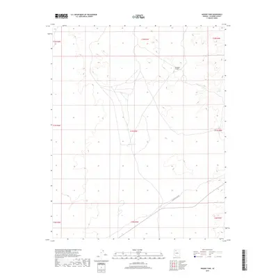
2018 Map of Higgins Tank
USGS Topo · Published 2018About this map
Hualapai Canyon cuts through this high desert landscape, a testament to the intricate drainage patterns of Coconino County. The region is defined by its arid cattle-ranching infrastructure, centered on vital water sources like Higgins Tank and Jones Tank. These water-catchment features were essential for the survival of livestock and the utility of the land in an area otherwise lacking permanent surface water. The map reflects the systematic surveying of the American West, showing the clear township and range divisions such as t31n r5w and t32n r5w. The infrastructure is sparse, with a focus on terrain and the critical hydrology required for the rural operations of the 21st-century high plateau.
Find a feature on this map
12 named features on this map. Tap any name to fly to it.
Don’t see what you’re looking for? This feature index may not catch every label — zoom into the map to look around manually.
Map Details
Editions of this 2018 Higgins Tank Map
This is the sole edition of this map. No revisions or reprints were ever made.
Other maps of this area
1886 · Chino
USGS Topo · 1:250,000
1886 · Kaibab
USGS Topo · 1:250,000
1891 · Chino
USGS Topo · 1:250,000
1948 · Williams
USGS Topo · 1:250,000

1953 · Grand Canyon
USGS Topo · 1:250,000
1954 · Williams
USGS Topo · 1:250,000
1956 · Williams
USGS Topo · 1:250,000

1957 · Grand Canyon
USGS Topo · 1:250,000

1958 · Grand Canyon
USGS Topo · 1:250,000
1960 · Williams
USGS Topo · 1:250,000