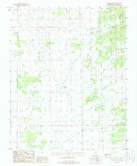
1988 Map of Higgins Tank
USGS Topo · Published 1988About this map
The eastern boundary of the Havasupai Indian Reservation marks the northeastern corner of this high-plateau landscape in Coconino County. Mapping of this area in the late 1980s reveals a terrain defined by its water-management features rather than human settlement. Essential livestock or wildlife resources like Higgins Tank and Jones Tank serve as primary landmarks in a region largely devoid of permanent structures. A long Trans Line corridor cuts through the center of the sheet, providing a modern utility contrast to the otherwise undisturbed topography. The absence of named roads and towns underscores the secluded character of this portion of northern Arizona, where simple Water Tank labels designate the most critical infrastructure for land use and survival.
Find a feature on this map
5 named features on this map. Tap any name to fly to it.
Don’t see what you’re looking for? This feature index may not catch every label — zoom into the map to look around manually.
Map Details
Editions of this 1988 Higgins Tank Map
This is the sole edition of this map. No revisions or reprints were ever made.
Other maps of this area

1886 · Chino
USGS Topo · 1:250,000

1886 · Kaibab
USGS Topo · 1:250,000

1891 · Chino
USGS Topo · 1:250,000

1948 · Williams
USGS Topo · 1:250,000

1953 · Grand Canyon
USGS Topo · 1:250,000

1954 · Williams
USGS Topo · 1:250,000

1956 · Williams
USGS Topo · 1:250,000

1957 · Grand Canyon
USGS Topo · 1:250,000

1958 · Grand Canyon
USGS Topo · 1:250,000

1960 · Williams
USGS Topo · 1:250,000