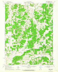
1962 Map of High Gate
USGS Topo · Published 1964About this map
High Gate serves as a focal point for this rural Missouri landscape where the Dry Fork and Peavine Creek drain the dissected plateau. The settlement patterns of the early 1960s reveal a deeply rooted community infrastructure, characterized by numerous family-named burial grounds and local institutions. Schools such as Lanes Prairie Sch and Harrison Center Sch are situated alongside spiritual centers like Skaggs Chapel and Bowles Chapel, reflecting the decentralized nature of rural life before regional consolidation.
Find a feature on this map
35 named features on this map. Tap any name to fly to it.
Don’t see what you’re looking for? This feature index may not catch every label — zoom into the map to look around manually.
Map Details
Editions of this 1962 High Gate Map
2 editions found
Other maps of this area

1934 · Linn
USGS Topo · 1:48,000

1934 · Bland
USGS Topo · 1:62,500

1934 · Redbird
USGS Topo · 1:62,500

1937 · Bland
USGS Topo · 1:62,500

1937 · Vienna
USGS Topo · 1:62,500

1938 · Redbird
USGS Topo · 1:62,500

1938 · Vienna
USGS Topo · 1:48,000

1942 · Linn
USGS Topo · 1:62,500

1945 · Linn
USGS Topo · 1:62,500

1949 · Saint Louis
USGS Topo · 1:250,000