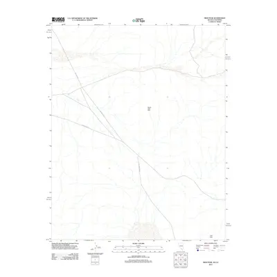
2012 Map of High Peak
USGS Topo · Published 2012About this map
The Devils Hole Hills anchor this high-desert landscape in Nye County, Nevada, near the California border. This 2012 survey captures a remote section of the Amargosa Desert where two primary arterial routes, Ash Meadows Rd and Bell Vista Rd, intersect to define the local transportation corridor. The terrain is characterized by broad alluvial fans and drainage channels that descend toward the desert floor from elevations such as High Peak. The map provides a precise look at the modern road network and geographic landmarks of the region during the early 21st century, offering a clear record of the area's physical geography and established access routes for researchers and land managers.
Find a feature on this map
4 named features on this map. Tap any name to fly to it.
Don’t see what you’re looking for? This feature index may not catch every label — zoom into the map to look around manually.
Map Details
Editions of this 2012 High Peak Map
This is the sole edition of this map. No revisions or reprints were ever made.
Other maps of this area

1908 · Furnace Creek
USGS Topo · 1:250,000

1910 · Furnace Creek
USGS Topo · 1:250,000

1940 · Eagle Tank
USGS Topo · 1:62,500

1948 · Death Valley
USGS Topo · 1:250,000

1951 · Eagle Mtn
USGS Topo · 1:62,500

1952 · Ash Meadows
USGS Topo · 1:62,500

1954 · Death Valley
USGS Topo · 1:250,000

1956 · Death Valley
USGS Topo · 1:250,000

1957 · Death Valley
USGS Topo · 1:250,000

1958 · Death Valley
USGS Topo · 1:250,000