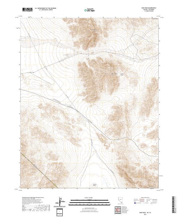
2021 Map of High Peak
USGS Topo · Published 2021About this map
Devils Hole Hills and the northern reaches of the Mojave Desert define this desert landscape along the border between Nye County, Nevada, and Inyo County, California. This modern survey illustrates the rugged transition from the Stewart Valley floor to the prominent heights of Pupfish Peak and High Peak. The area is characterized by vast alluvial fans and significant topographic relief, with the eastern edge of the Johnnie Range looming at the map's margin.
Find a feature on this map
17 named features on this map. Tap any name to fly to it.
Don’t see what you’re looking for? This feature index may not catch every label — zoom into the map to look around manually.
Map Details
Editions of this 2021 High Peak Map
This is the sole edition of this map. No revisions or reprints were ever made.
Other maps of this area

1908 · Furnace Creek
USGS Topo · 1:250,000

1910 · Furnace Creek
USGS Topo · 1:250,000

1940 · Eagle Tank
USGS Topo · 1:62,500

1948 · Death Valley
USGS Topo · 1:250,000

1951 · Eagle Mtn
USGS Topo · 1:62,500

1952 · Ash Meadows
USGS Topo · 1:62,500

1954 · Death Valley
USGS Topo · 1:250,000

1956 · Death Valley
USGS Topo · 1:250,000

1957 · Death Valley
USGS Topo · 1:250,000

1958 · Death Valley
USGS Topo · 1:250,000