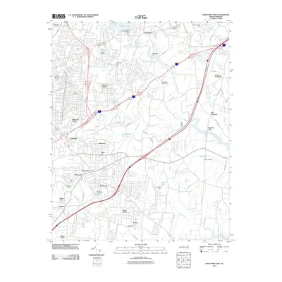
2010 Map of High Point East
USGS Topo · Published 2010About this map
The Deep River winds through this Greensboro corridor, where suburban expansion meets legacy Piedmont landmarks. Historic community hubs like Jamestown and Archdale anchor the landscape, while numerous smaller neighborhoods such as Bakertown, Springfield, and Allen Jay fill the spaces between the developing highway network. Local history is etched into the terrain at the Green Hill Cemetery and the site of Freeman Mill on the river. Water management is a central theme, evidenced by the series of impoundments including High Point Lake, Linthicum Lake, and Kivett Lake. The map reveals the transitional nature of this area in 2010, showing the intersection of newer developments like Stones Throw and Robins Nest with long-standing rural waypoints like Kirkman Crossroad. The inclusion of Darr Field and multiple municipal dams highlights the civic infrastructure supporting this growing North Carolina region.
Find a feature on this map
97 named features on this map. Tap any name to fly to it.
Don’t see what you’re looking for? This feature index may not catch every label — zoom into the map to look around manually.
Map Details
Editions of this 2010 High Point East Map
This is the sole edition of this map. No revisions or reprints were ever made.
Other maps of this area

1949 · High Point West
USGS Topo · 1:24,000

1950 · High Point East
USGS Topo · 1:24,000

1951 · High Point East
USGS Topo · 1:24,000

1951 · Guilford
USGS Topo · 1:24,000

1951 · Fair Grove
USGS Topo · 1:24,000

1951 · Greensboro
USGS Topo · 1:24,000

1953 · Raleigh
USGS Topo · 1:250,000

1953 · Charlotte
USGS Topo · 1:250,000

1953 · Winston-Salem
USGS Topo · 1:250,000

1953 · Greensboro
USGS Topo · 1:250,000