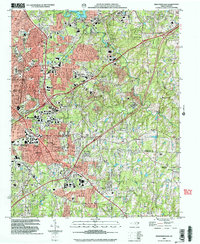
2002 Map of High Point East
USGS Topo · Published 2004About this map
High Point serves as the focal point for this Piedmont landscape at the start of the 21st century, showing the dense suburban development and transportation corridors that define the region. The map captures the significant expansion of educational institutions, including the campus of High Point University and Guilford Tec Comm College. Residential growth is evident in established and emerging neighborhoods like Sherwood Village, Melbourne Heights, and Bakertown, which contrast with the older industrial and mill-based character of Jamestown and Oakdale.
Find a feature on this map
48 named features on this map. Tap any name to fly to it.
Don’t see what you’re looking for? This feature index may not catch every label — zoom into the map to look around manually.
Map Details
Editions of this 2002 High Point East Map
This is the sole edition of this map. No revisions or reprints were ever made.
Other maps of this area

1949 · High Point West
USGS Topo · 1:24,000

1950 · High Point East
USGS Topo · 1:24,000

1951 · High Point East
USGS Topo · 1:24,000

1951 · Guilford
USGS Topo · 1:24,000

1951 · Fair Grove
USGS Topo · 1:24,000

1951 · Greensboro
USGS Topo · 1:24,000

1953 · Raleigh
USGS Topo · 1:250,000

1953 · Charlotte
USGS Topo · 1:250,000

1953 · Winston-Salem
USGS Topo · 1:250,000

1953 · Greensboro
USGS Topo · 1:250,000