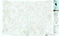
1981 Map of High Rock Canyon
USGS Topo · Published 1981About this map
The High Rock Canyon region of northwest Nevada reveals a landscape defined by isolated water sources and high-altitude peaks, including Big Mountain and Donnelly Peak. This 1981 survey by the United States Geological Survey, produced in cooperation with the Nevada Bureau of Mines and Geology, documents the vital infrastructure of the ranching and mining era. Named springs like Grassy Rock Springs and Pinto Springs are scattered throughout the Hays Canyon Range, while the Leadville Mine sits at the head of Leadville Canyon, marking the industrial history of the Granite Range.
Find a feature on this map
186 named features on this map. Tap any name to fly to it.
Don’t see what you’re looking for? This feature index may not catch every label — zoom into the map to look around manually.
Map Details
Editions of this 1981 High Rock Canyon Map
2 editions found
Other maps of this area

1886 · Alturas
USGS Topo · 1:250,000

1886 · Honey Lake
USGS Topo · 1:250,000

1886 · Disaster
USGS Topo · 1:250,000

1886 · Granite Range
USGS Topo · 1:250,000

1889 · Long Valley
USGS Topo · 1:250,000

1891 · Honey Lake
USGS Topo · 1:250,000

1892 · Alturas
USGS Topo · 1:250,000

1893 · Honey Lake
USGS Topo · 1:250,000

1893 · Disaster
USGS Topo · 1:250,000

1894 · Granite Range
USGS Topo · 1:250,000